Tag Archives: crowdmap

Guardian experiments with Crowdmap for Pope’s visit

Following BBC London’s use of open source mapping technology Crowdmap to cover the London Underground strikes earlier this month, the Guardian is using the tool to record reports of the Pope’s visit to the UK.

The map blends text, image and video reports from the Guardian’s own team with those submitted by readers and papal bystanders. There’s a certain tongue-in-cheek element to it as well, with categories for popemobile sightings and miracles alongside reports on protests and official news.
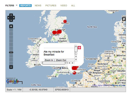
Explains the Guardian’s Paul Lewis in a blog post:

You can send anything, but we’re particularly interested in incidents, events and insights from people who find themselves at the right place at the right time, spotting something that the papal entourage of global media miss. It is important that you tell us where you are when you send your dispatch.

The majority of the updates plotted so far are from the Guardian, but it will be interesting to see how tools like this take off and how they might be further integrated into live reporting.

What the BBC learned from using Crowdmap tool to cover tube strikes

On Tuesday, Journalism.co.uk reported that the BBC were using Ushahidi’s new Crowdmap technology to record and illustrate problems on the London Underground caused by the day’s tube strikes.

The BBC’s Claire Wardle has helpfully followed up on her experiences with a post on the College of Journalism website explaining how it went, what they changed and what they would like to do with the technology next time.

She explains the reasoning behind decisions taken throughout the day to amend their use of the platform, such as moving across to Open Street Map as a default mapping tool and the introduction of a time stamp at the start of each headline. She also provides some suggestions on how the platform could be improved in the future, including provisions for greater information outside of the map.

It would have be useful if there’d been a scrolling news bar at the top so we could have put out topline information which we knew everyone could see by just going to the map. Something like ‘the Circle Line is suspended’ or ‘the roads are really starting to build with traffic’ was very hard to map.

See the full post here…